BioAIRad
Biodiversity monitoring of the AIrspace with Radars
Abstract
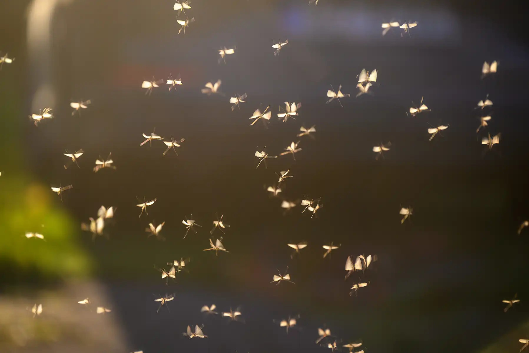
Countless birds, bats and insects move in the airspace. Their movements link habitats, communities and ecosystems, and influence various ecological processes, raise human-wildlife conflicts and provide services and disservices that are relevant to human agriculture, economy and health. Biodiversity monitoring of this important yet largely overlooked habitat can only be achieved with remote-sensing technology such as radars. Over the past years, we have started using the networks of weather radars in the EU and the USA to quantify these biomass fluxes and understand their environmental drivers. Additionally, we set up a network of small-scale radars that detect individual animals and various of their features. Due to their continuous operation and large-scale coverage, radars constitute a unique resource for establishing a standardized biodiversity monitoring system for the airspace. However, to tap the full potential of radars for biodiversity monitoring and produce tools for various stakeholders, data science approaches are needed to increase the taxonomic resolution of radar products, to interpolate between individual radar locations and to develop predictive models of aerial movements of birds, bats and insects. The latter need to consider multiple weather and climatic variables, location-specific geographic information and habitat use. In this project, we aim at making a major step forward in using the potential of radars, by employing state-of-the-art data science approaches for the classification of radar signal and for modelling and forecasting the spation-temporal movements of aerial biodiversity. In the medium- to longer term, we envisage the methods developed, tested and applied here to be implemented as part of a large-scale Swiss insect and aerial fauna monitoring. In the longer term, we plan to include the methods in applications that deliver data products to stakeholders from various societal sectors – wind energy, aviation safety, agriculture.
People
Collaborators

Paraskevi holds a Bachelor's degree and a PhD in Computer Science from Aristotle University of Thessaloniki, obtained in 2014 and 2021 respectively. Her thesis was focused on supervised and unsupervised Deep Learning methodologies with applications in computer and robotic vision as well as timeseries analysis. Her research interests include deep learning for computer vision, robotics, timeseries forecasting and gravitational waves analysis.

Michele received a Ph.D. in Environmental Sciences from the University of Lausanne (Switzerland) in 2013. He was then a visiting postdoc in the CALVIN group, Institute of Perception, Action and Behaviour of the School of Informatics at the University of Edinburgh, Scotland (2014-2016). He then joined the Multimodal Remote Sensing and the Geocomputation groups at the Geography department of the University of Zurich, Switzerland (2016-2017). His main research activities were at the interface of computer vision, machine and deep learning for the extraction of information from aerial photos, satellite optical images and geospatial data in general.
PI | Partners:
Swiss Federal Institute for Forest, Snow and Landscape Research (WSL)
- Dr. Silke Bauer (main PI)
- Dr. Elske Karolien Tielens
Agroscope
- Dr. Eva Knop
- Dr. Benjamin Rutschmann
Swiss Ornithological Institute
Dr. Birgen Haest
description
Motivation
The movements of birds, insects and bats in the airspace link otherwise separated habitats, communities and ecosystems, and have implications for various ecological processes, raise human-wildlife conflicts and provide services (pollination, seed-dispersal, pest control, nature’s contribution to people) and disservices (pathogen dispersal, agricultural damage) that are relevant to human agriculture, economy and health. Biodiversity monitoring of this important yet largely overlooked habitat can only be achieved with remote-sensing technology such as radars. Due to their continuous operation and large-scale coverage, radars constitute a unique resource for establishing a standardized biodiversity monitoring system for the airspace (Figure 1). However, to tap the full potential of radars for biodiversity monitoring and produce tools for various societal sectors, data science approaches are needed to increase the taxonomic resolution of radar products, to interpolate between individual radar locations and to develop predictive models of aerial movements of birds, bats and insects.
Proposed Approach / Solution
BioAIRad aims to take the field of biodiversity monitoring using radars to the next level by advancing the taxonomic resolution of small-scale and weather radars, with a particular focus on insect identification, and by developing interpolation and predictive models of bird and insect biomass flows in the airspace that lay the foundation to a range of stakeholder tools. Within BioAIRad we will improve, extend, or newly develop animal classification algorithms for data from ‘conventional’ small-scale radars (type MR1), next-generation small-scale radars (type MR2), and weather radars, respectively. As the datasets differ between radar systems, different methods will be developed for each radar type. Finally, we will develop methods to interpolate and predict aerial movements in three-dimensional space building on data and methods developed using weather radar and small-scale radars.
Impact
In addition to biodiversity monitoring and research, this project will benefit many stakeholders, for which aerial insect, bat and bird diversity and movements are relevant. For wind farm operators, the project could be useful in their impact assessment as well as operational curtailment. In aviation safety, the results of the project could be utilized in bird strike prevention. In nature conservation management, quantification of aerial biodiversity might benefit from the progress made in the duration of BioAIRad. In agriculture, the models developed in the project could be used for immigration forecasting of crop pests, or as dispersal vectors for diseases of crop and livestock. Epidemiologists and public health agencies might benefit in their studies of spread of zoonotic diseases by migratory animals. In meteorology, the project extends the value of existing infrastructure, and could potentially lead to improved meteorological products.

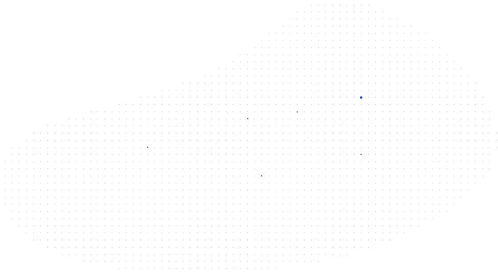
Figure 1. Two major radar systems are currently used for the monitoring of aerial insect, bat and bird numbers and movements: small-scale vertical looking radars and large-scale weather radars that differ in basic measurement characteristics and consequently, also in features that can be extracted and in their taxonomic resolution. This project will use data from two types of small-scale radar (MR1 and next-gen MR2), as well as weather radar – the basic measurement characteristics of which are depicted as well as the current distribution of devices in Europe (a), sample picture for small-scale (b) and weather radar devices (c) as well as a typical image of weather radar data (d).
Presentation
Gallery
Annexe
Additional resources
Bibliography
- Bauer S, Tielens EK, Haest B. 2024 Monitoring aerial insect biodiversity: a radar perspective. Philos. Trans. R. Soc. B 379. (doi:10.1098/RSTB.2023.0113)
- Haest B, Hertner F, Schmid B, Preatoni D, De Groeve J, Liechti F. 2023 birdscanR: Migration Traffic Rate Calculation Package for Birdscan MR1 Radars. (doi:10.5281/ZENODO.7665531)
- Knop E, Grimm ML, Korner-Nievergelt F, Schmid B, Liechti F. 2023 Patterns of high-flying insect abundance are shaped by landscape type and abiotic conditions. Sci. Rep. 13, 1–8. (doi:10.1038/s41598-023-42212-z)
Publications
Related Pages
- The PIs of the three partnering teams are also involved in an ongoing international Biodiversa+ project (HiRAD ), which addresses clear societal questions and needs such as spatio-temporal modelling and forecasting of aerial movements for biodiversity and global change, sustainable energy transition, and public health.
More projects
ACROSS
Dedgeflow

CHUV: Heracles - Sepsis Model

AI-Driven Political Monitoring
More projects
News
Latest news
SDSC and PSI teams jointly explore the AI potential of large-scale infrastructures
SDSC and PSI teams jointly explore the AI potential of large-scale infrastructures
Coding the Future: Energy Data Hackdays Expand to French-speaking Switzerland
Coding the Future: Energy Data Hackdays Expand to French-speaking Switzerland

Science des données : le SDSC et le Canton de Vaud soutiennent quatre projets appliqués
Science des données : le SDSC et le Canton de Vaud soutiennent quatre projets appliqués
Contact us
Let’s talk Data Science
Do you need our services or expertise?
Contact us for your next Data Science project!